By Brian French, founder and publisher, Florida Authority Network
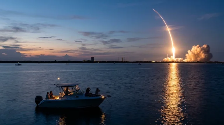
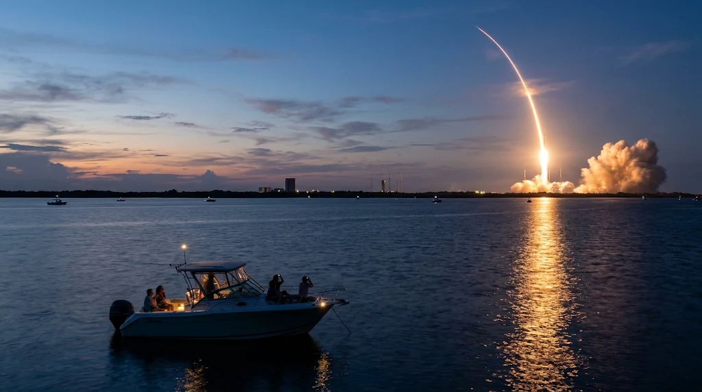
Few places on earth combine rocket launches, cruise ships, sportfishing fleets and a sprawling estuary within a few miles of each other. Florida’s Space Coast does. Cape Canaveral, Merritt Island, Titusville, Cocoa Beach and Port Canaveral sit along a stretch of Atlantic shoreline and Indian River Lagoon waterway where launch pads, shipping channels and boat ramps share the same geography. For boaters, that creates a rare opportunity to watch a liftoff from the water, and a real responsibility to understand the safety rules that surround it.
This guide explains how the Coast Guard manages the waters around launches, where boaters can legally and safely watch from the water, what to know about Port Canaveral and the Intracoastal Waterway in Brevard County, and what to expect from marine services in the Merritt Island and Titusville corridor. It draws on Coast Guard releases, federal regulations, trade reporting and local guidance. Because launch schedules and restricted areas change from event to event, always check current notices before you head out.
Where Aerospace and Marine Recreation Meet
The Space Coast’s marine economy has several layers. There is the recreational side: fishing, cruising, paddling and wildlife viewing across the Indian River Lagoon, Banana River and Mosquito Lagoon, and offshore trips from Port Canaveral. There is the commercial side: cruise terminals, cargo operations and marine contractors at the port. And there is the aerospace layer, in which the Coast Guard and other agencies must clear water space around launch sites so that vessels are not in harm’s way.
Coast Guard sector and station crews at Port Canaveral enforce restricted areas, and the range’s operators coordinate with NASA and commercial launch companies to define hazard areas. When a major launch is planned, the effects can reach well beyond the immediate vicinity of the pad, including inshore waters, nearshore Atlantic waters and areas far offshore.
Boating Safety During Rocket Launches
The most important point for boaters is that launch day restrictions are real and enforced. The Coast Guard describes the measures as limited access areas that protect the maritime public and launch infrastructure.
What the Coast Guard establishes
For NASA’s Artemis II launch on April 1, 2026, the Coast Guard and partner agencies applied and enforced limited access areas that included a security zone, a regulated navigation area and a safety zone. Coast Guard Station Port Canaveral crews headed offshore to enforce the areas, and Coast Guard Auxiliary members promoted boating safety at the Port Canaveral boat ramp. The Coast Guard also recommended that all mariners stay clear of the launch hazard area until after a successful launch, even beyond the formally restricted zones.
For routine launches, the pattern is similar. The Captain of the Port issues a notice to mariners and local notice to mariners that sets out the limited access safety areas, and coordination with the range and with launch providers produces the published boundaries. A Florida sportfishing publication describes the Coast Guard posting a “launch security zone” and a “launch danger zone” advisory for each launch, with cruise ships and cargo vessels required to stay in port or at sea during the hazard window. The danger zones shown on digital maps can cover inshore and nearshore waters, including the southern Mosquito Lagoon, northern Banana River Lagoon, parts of the Indian River Lagoon and nearshore Atlantic waters including the port itself, and a larger zone can extend eastward 10 to 100 miles into the ocean.
Permanent security zones near NASA property
In addition to launch-specific zones, there are permanent security zones around portions of the Cape Canaveral and Kennedy Space Center waterfront. Federal regulations at 33 CFR 165.701 describe a security zone that includes the perimeter of the Cape Canaveral Barge Canal and parts of the Banana River and extends along the eastern shoreline of the Indian River to near the NASA Causeway. Boaters should not enter these areas without authorization, and should obey posted signs and instructions from law enforcement.
How to get current information
- Monitor VHF Channel 16. The Coast Guard broadcasts information on restricted areas as each launch approaches.
- Check the Coast Guard’s local notice to mariners and the launch provider’s published safety zones.
- Use a reliable launch schedule, but remember that launches slip, and restricted areas can change with the schedule.
- Plan to be in your viewing location well before the restricted period begins, and have an exit plan if the launch is scrubbed.
Prime Viewing Areas From the Water
Boaters can watch launches from the Intracoastal Waterway and from non-restricted portions of the Indian River and Mosquito Lagoon, according to guidance published by launch schedule and local tourism sites. A rocket launching from the Kennedy Space Center or Cape Canaveral Space Force Station is visible from many miles away, so you do not need to be close to enjoy the show. Staying outside restricted areas is not only legal, it is also safer, and sound and light effects remain dramatic at a distance.
Indian River viewing
The Indian River near Titusville is a favorite location because the river is roughly three miles wide at that point, giving a clear sightline to the launch pads across the water. Space View Park in downtown Titusville is the most popular shore-based viewing site, and boaters on the water nearby share a similar view. If you are farther south on the Indian River, you will generally look northeast to see the launch. Twilight and nighttime launches add dramatic reflections on the water.
Atlantic and Port Canaveral viewing
Launches from the southern pads at Cape Canaveral are often best viewed from Cocoa Beach, Port Canaveral and nearby waters. However, much of the nearshore Atlantic and the port area itself may fall inside danger zones on launch days. Boats should not assume that they can anchor off the beach or in the port entrance channel to watch. Check the notice to mariners for the specific launch and respect all boundaries.
Charter options
For visitors who do not have a boat, companies such as Island Boat Lines and Space Coast River Tours offer launch-day cruises on the Indian River. Charters are a reasonable way to enjoy the experience with an experienced captain who knows where the legal viewing areas are.
Launch-Day Boating Checklist
| Step | Action |
|---|---|
| 1 | Check the launch time and the Coast Guard’s notice to mariners for restricted areas |
| 2 | Choose a viewing spot outside all restricted zones, such as the non-restricted Indian River or the Intracoastal Waterway |
| 3 | Arrive early, anchor safely and monitor VHF Channel 16 |
| 4 | Keep life jackets, a working radio and navigation lights ready for evening launches |
| 5 | Expect delays and scrubs, and have fuel and supplies to wait |
| 6 | Leave the area carefully after launch, because many boats depart at once |
Port Canaveral: Deep Water and Shared Space
Port Canaveral is one of Florida’s major deep-water ports and a home for cruise ships, cargo vessels, offshore fishing boats and charter operators. Large cruise ships and cargo ships move through the port entrance channel, and recreational boaters need to treat them with respect. Commercial vessels have limited maneuverability, particularly in the channel. Small boats should keep clear, maintain a constant radio watch and avoid crossing close ahead of large vessels.
The port is also a base for offshore sportfishing. Anglers head out through the port’s inlet to the Atlantic for species ranging from mahi-mahi and kingfish to cobia, and the port’s proximity to the Gulf Stream and nearshore wrecks and reefs makes it attractive. Launch days can affect fishing plans, because the offshore danger zones can close large areas of the fishery for several hours. A Florida publication that covers saltwater fishing has noted that every launch can trigger hours of varying security and danger zones offshore, and that anglers are warned to avoid them.
When planning a trip from Port Canaveral, consider timing around both the tide at the inlet and the launch schedule. If a launch is planned, you may have a narrow window to get out and back. Always check weather, particularly in summer when thunderstorms build quickly over the Space Coast.
Navigating the Indian River Lagoon and the Intracoastal Waterway
Brevard County’s portion of the Atlantic Intracoastal Waterway runs through the Indian River Lagoon, a shallow estuary with extensive flats, grass beds and mangrove edges. It is beautiful and rich in wildlife, but it can be unforgiving for deep-draft boats and for operators who stray from the marked channel.
Bridges and schedules
Several bridges cross the waterway in Brevard County. Their clearances and opening schedules vary, and operating rules can change. Check the current bridge schedule and verify the vertical clearance against your boat’s air draft before you start a trip. Bridge tenders typically monitor VHF channels and respond to requests, but they may not open on demand during certain hours or at times of heavy traffic.
Ecology and manatee protection
The Indian River Lagoon has faced significant environmental stress in recent years, including seagrass loss and algal blooms, and extensive restoration work is underway. Boaters can help by staying in marked channels, observing manatee and slow-speed zones, avoiding prop damage to seagrass and not discharging any waste. Manatees gather in some waters of the region in cooler months, and speed zones are enforced.
Shoals and depth
Depths in the lagoon vary considerably from the charted channel to the adjacent flats. A boat that draws more than a couple of feet should be careful when leaving the channel, especially at lower tides. Updated charts and a depth sounder are essential, and local advice from marinas and fishing guides is valuable.
Marine Services in the Merritt Island and Titusville Corridor
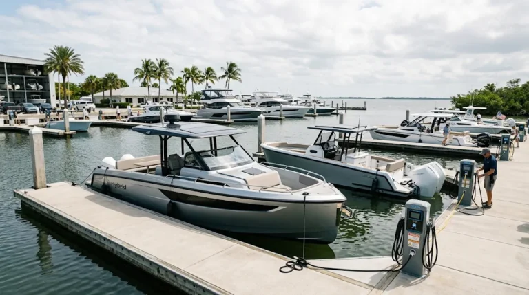
The Space Coast’s marine services sector supports a large boating community, and the Merritt Island and Titusville area is a convenient base for service. Boaters can expect to find marinas, dry storage, boat yards, engine repair, electronics installation, fiberglass and paint shops, and parts suppliers in the region. The same technical labor pool that supports aerospace work can also support high-quality marine fabrication and electronics.
When choosing a service provider, ask about certifications from engine manufacturers and organizations that credential marine technicians, request written estimates, and ask for references from owners of similar boats. For larger work such as repowers or refits, confirm that the yard carries adequate insurance and that its schedule is realistic. Hurricane season can crowd yards, so schedule major projects well before or after the peak.
Planning a Space Coast Boating Trip
- Check the launch schedule and decide whether you want to be on the water for launch day or avoid it.
- Review the Coast Guard notices, VHF broadcasts and any posted limited access areas.
- Choose a viewing location in the Indian River or Intracoastal Waterway outside restricted zones.
- Check bridge schedules, tides and weather, and confirm your boat’s draft and air draft.
- Plan fuel, provisions and safety gear for a long wait.
- Respect manatee zones and avoid damaging seagrass.
- Have a plan for scrubs, delays and heavy traffic after the launch.
The Space Coast offers one of the most memorable boating experiences in Florida. A launch seen from the water can be a highlight of any season, as long as boaters respect the rules that keep everyone safe. Knowing the restricted areas, listening to the Coast Guard and planning for variable conditions will make the experience safe, legal and rewarding.
Frequently Asked Questions
Can I watch a rocket launch from my boat in Florida?
Yes, from non-restricted waters such as parts of the Indian River, Mosquito Lagoon and the Intracoastal Waterway. You must stay out of the Coast Guard’s limited access areas.
How do I find the restricted areas for a launch?
Listen to VHF Channel 16, check the Coast Guard notice to mariners and consult the launch provider’s published safety information for the specific launch.
Where is the best place to view a launch on the Indian River?
Waters across from Titusville near Space View Park are popular because the river is about three miles wide there, giving a clear view toward the pads.
Can I fish offshore from Port Canaveral on launch day?
It depends on the launch. Danger zones can cover large areas offshore for several hours, and anglers are warned to avoid them. Check the notice to mariners before you go.
What happens if I enter a security or safety zone?
Entering restricted areas can lead to enforcement action by the Coast Guard or other agencies, and it puts you and others at risk. Follow instructions from law enforcement.
Are there boat tours for launches?
Yes. Companies such as Island Boat Lines and Space Coast River Tours offer launch-day cruises on the Indian River.
About the Author
Brian French is the founder and publisher of the Florida Authority Network, a collection of more than 35 Florida business news, industry, video and press release publications. His career before publishing was in finance: he served as a Vice President and Trust Officer at both Merrill Lynch and SunTrust, and as a Portfolio Manager at Merrill Lynch Trust Company and Merrill Lynch Investment Managers – Private Investors. Earlier, he was a Financial Advisor at Shearson American Express and E.F. Hutton and a Common Stock Analyst at Independence Securities in Greensboro, North Carolina. He passed Level II of the CFA Program. Brian lives near Tampa, Florida, with his wife.
This article is general information for Florida boaters and marine businesses. It is not legal, tax, insurance or investment advice. Confirm current rules, fees and dates with the responsible agency or a licensed professional before you act.
Sources and Further Reading
- U.S. Coast Guard, Coast Guard, Partner Agencies to Support Historic Artemis II Launch (news.uscg.mil)
- DVIDS, Coast Guard Auxiliary Promotes Safe Boating During NASA Artemis II Launch (April 1, 2026)
- GlobalSecurity.org, Coast Guard release on Artemis II launch safety (March 31, 2026)
- Sea Power Magazine, Space Mission Support: Coast Guard Patrols Restricted Areas Around Launches, Re-Entries
- Florida Sportsman, Conservation: Port Canaveral Fishing and Launch Zones
- Saving Seafood, Space Coast launches trigger offshore security and danger zones (July 28, 2025)
- Electronic Code of Federal Regulations, 33 CFR 165.701 (Cape Canaveral security zone)
- Space Launch Schedule, Watch a Rocket Launch by Boat on Florida’s Space Coast
- We Report Space, Where to Watch a Rocket Launch on Florida’s Space Coast
- Federal Register (Coast Guard), Safety Zone; Atlantic Ocean, Cape Canaveral, FL (proposed rule)
About the Author